In Victorian times, it was to an officer’s advantage to be good at sketching. This is subject was not only on the syllabus at Sandhurst but also at the Army Staff at Camberley until the Anglo-Boer War of 1899–1902, and later.
The reason was the British Army seldom had properly surveyed maps of wherever it was fighting, and so an important part of the duties of a junior officer and of a trained staff officer in particular, was to be able to produce a good sketch map and panorama for his commanding officer.
Lt-Col John North Crealock was a veteran of the Indian Mutiny and a skilled painter in watercolours. He was the younger brother of Major-General Henry Hope Crealock, who commanded the First Division during the second invasion of Zululand in May 1879. Crealock was slightly wounded at the Battle of Gingindlovu on the 2 April 1879 and, in July 1880, on his return to England, he was appointed commanding officer of the 95th Regiment of Foot, serving with them in Gibraltar in 1881, Egypt in the 1882 campaign, and then on to India.
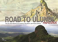
Crealock’s paintings were given to the Regimental Museum, where they are now housed. In 1964, a selection of the watercolours was copied by the University of Natal Press and published in a book entitled The Road to Ulundi. South African historian Ken Gillings spent three years identifying and photographing the sites depicted in the book and was impressed by their accuracy.
The trustees of the Museum of the Mercian Regiment (of which the Sherwood Foresters was an antecedent regiment) have kindly given the publishers the go-ahead to republish the sketches, with the accompanying photographs and explanatory notes prepared by Gillings. The result is a truly unique item of militaria, which is likely to become a sought-after item of Africana.
§ Back to list |


